Google is continuing to improve its Google Maps offering by adding more and more features. The app recently gained new functionalities, including food orders, speed trap and speed limit indicators, popular restaurant dishes, as well as an on-screen speedometer. Now the Android-maker is adding safety features including hurricane forecast cones, earthquake shakemaps, flood forecasts, and crisis navigation warnings.
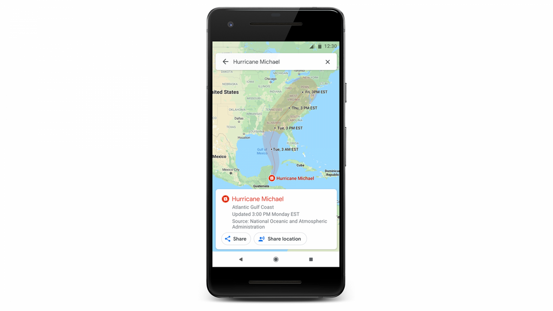
With hurricane forecast cones, earthquake shakemaps, and flood forecasts, as their names imply, Google Maps will be able to offer users detailed visualizations about these weather and nature events.
In the days leading up to a hurricane, you’ll see a crisis notification card on Google Maps that automatically appears if you’re near the impacted area.
After an earthquake happens, the application will also display the quake’s epicenter, its magnitude, along with color coding to indicate how intense the shaking was in surrounding areas. Similarly, coming “late this summer”, Google Maps will offer you warnings if it believes that the route you’re taking is going through an area affected by a crisis event, and, when possible, it will attempt to reroute you on a safer itinerary.
In terms of availability, “hurricane forecast cones and earthquake shakemaps will start rolling out in the coming weeks on Android, iOS, desktop, and mobile web. Flood forecasts visualizations will soon roll out starting in Patna, India, and then expand to the Ganges and Brahmaputra regions on Android, desktop, and mobile web“.
